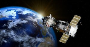
A new project led by Griffith University is using big data from satellites to assess the impacts of droughts and water extraction on groundwater resources in Australia.
Funded by an Australian Research Council (ARC) Discovery Early Career Researcher Award worth more than $428,000, the project will generate insights into the mechanisms driving changes in groundwater availability and help identify the risks associated with groundwater extraction.
“More than half of the world’s largest aquifers have rapidly declining groundwater storage, jeopardising global food and water security and ecosystems’ sustainability,” said chief investigator Dr Christopher Ndehedehe from the Australian Rivers Institute.

“The impacts of droughts and water extraction on groundwater resources are currently poorly understood in Australia and difficult to monitor, threatening national water security and drought resilience.”
Dr Ndehedehe’s project will employ unprecedented ways of harnessing big data from satellites to assess groundwater status, improving the capability of water resource management agencies to monitor water availability and sustainably manage these critical resources.
The results of this research will help farmers and communities to reduce adverse outcomes from drought by enabling earlier access to the critical data needed to inform production decisions.
The project will make further use of this data for environmental monitoring, which could be incorporated into existing online water monitoring platforms, generating publicly accessible groundwater information and expanding global markets for Australian satellite-based monitoring.
“For example, excessive groundwater pumping draws down the water table and, under prolonged drought conditions and higher evaporation, groundwater depletion causes wells to run dry because recharge is unable to replace the groundwater as quickly as pumping removes it,” Dr Ndehedehe said.
“This loss in groundwater can affect water-dependent ecosystems, including declines in unique aquatic biodiversity and tree mortality, resulting in the collapse of forests.
“However, our knowledge of groundwater drought and the extent to which it occurs is lacking due to insufficient in-situ data and capacity to quantify and predict changes in water storage through space and time.”
Satellites like the Gravity Recovery and Climate Experiment (GRACE) has enabled the monitoring of freshwater changes, including groundwater. But how well do they compare with monitoring of groundwater levels from bores, and can this technology be established as a foundation for water resources planning and accounting in Australia?
This project is an important opportunity to evaluate the use of GRACE satellite data as an independent line of evidence to understand the influence of climate variability and water extraction on groundwater availability. A key goal is to develop a machine learning technique that combines both big satellite data and in-field measurements/observations of rainfall, temperature, etc to identify areas where groundwater resources are affected by human water extraction or drought.
“With access to big data and computational infrastructure, it is possible to quantify groundwater withdrawals by incorporating climate data and satellite observations of evapotranspiration, surface water, and landcover change in a machine learning model,” Dr Ndehedehe said.
“This should overcome the challenges and large degree of uncertainty associated with numerical models and difficulty in applying them over sizeable areas.
“This research will overcome the key impediment associated with quantifying groundwater use in Australia and provide a reliable groundwater withdrawal monitoring technique, which can be incorporated into national groundwater information systems to support drought policy and the strategic management of freshwater in water-stressed agricultural areas.”
The project will provide a new national capability to assess and monitor groundwater resources from space, providing data for government, farmers, communities and traditional owners to better prepared for future droughts, increase disaster preparedness and sustainably manage groundwater resources in a changing climate.
Key findings and outcomes from the project include the development of a novel machine learning framework to downscale the coarse spatial resolution of GRACE data, making it more detailed so it can be used for the management of water resources on local scale.