Griffith University researchers are using the same technology that helps control automated vehicles and is used in speed cameras to find ancient sites in the Mariana Islands.
Published in the Journal of Computer Application in Archaeology the paper explores the use of lidar on the western Pacific island of Guåhan (Guam) to map sites which previously may not have been discovered.
Lidar (Light detection and ranging) is a non-invasive remote sensing technique that works by sending out laser pulses and calculating the return time from surface reflections.

Dr Andrea Jalandoni.
Dr Andrea Jalandoni, a digital archaeologist from Griffith University’s Centre for Social and Cultural Research, said the research was being used to showcase what known archaeological sites look like on lidar so that more archaeological sites can be found.
‘Several of the sites are from the Latte, Spanish and Modern periods and we see that lidar is a very effective way to see and map the sites that are obscured and may not be visible due to vegetation,’ Dr Jalandoni said.
‘The benefits of using this technology are great for the community of GuÃ¥han as it offers a non-invasive way to investigate sites and assist with their cultural heritage management.”
Dr Jalandoni’s work was done in partnership with other archaeologists and mapping specialists from GuÃ¥han.
‘This pilot study using lidar has opened my eyes to new sites and historic landscapes I worked in, but never envisioned had such unrealised potential,’ said Dr Boyd Dixon, one of the archaeologists on the project.
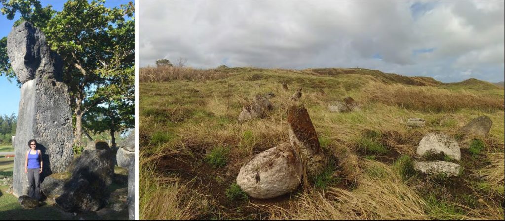
Dr Andrea Jalandoni provides scale at House of Taga Latte near Fena Lake
Victor H. Torres, an Indigenous archaeologist and mapping specialist, said the work is an interesting look at how a modern technology like lidar can contribute to the discovery and understanding of the past.
‘In our project, we showed one application of lidar data for GuÃ¥han but there are many other uses, like sea level rise modelling or construction monitoring,’ said Maria Kottermair, a mapping specialist.
“We have only scratched the surface and there is a lot more that can be done with this technology.”