Griffith University researchers have travelled to north Queensland to assess the impacts of Cyclone Debbie for vital coastal resilience modelling.
A team from the Griffith Centre for Coastal Management, which sits within the new Cities Research Institute, has looked at the impact of storm surge on coastal communities and will now use the data to improve future strategies.
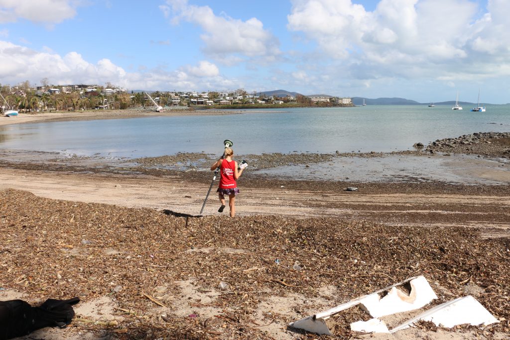
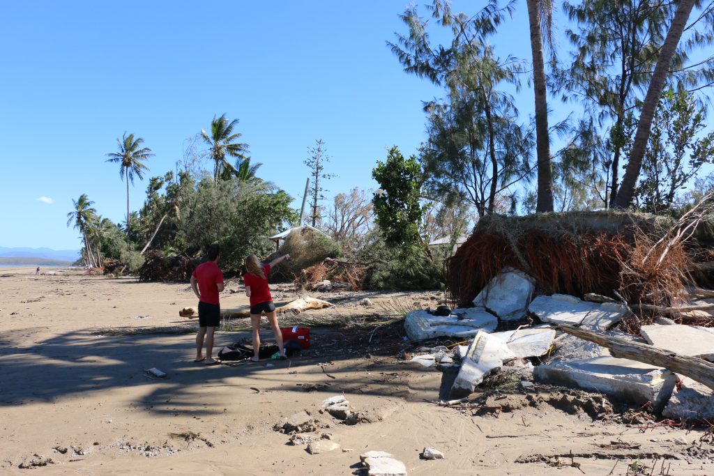
Senior research fellow Dr Serena Lee and PhD candidate Gaelle Faivre took measurements of the landward extent of the rush of seawater that occurs as a result of surge. They will work in partnership with the Department of Science, Information Technology and Innovation.
Visiting key data sites in Mackay and the Whitsunday Coast, the researchers were looking for debris lines and watermarks on buildings.
“Everyone is understandably focused on cleaning up and removing debris after the event, but to us as a scientist, that’s important data,” Dr Lee said.
Griffith researchers assess key data sites.
“Storm surge is often the most damaging aspect of a cyclone impacting the coast, with water level being increased many metres over normal tide levels.”
The researchers will now use the information to verify the Centre’s models of storm surge inundation across the land as a cyclone makes landfall.
“We were lucky that where we went the residents were open to our workand helpful in pointing out areas where we would find debris left by the surge,” Dr Lee said.
“The places we were able to get the best measure of storm surge inundation were from empty blocks with no houses, where the debris had not been cleared. These sites provided clear measurements of how far the storm surge caused by Cyclone Debbie moved over land.”
Dr Lee said this information was important because whenever they run a numerical model they need to tests its accuracy and can only do that if they have actual measurements.
“Because storm surges don’t happen often, there isn’t many measurements you can use to test your model,” she said.
“Collecting this data is also complicated by the fact that accessing these sites after a disaster can be difficult. Often by the time you have managed to get to a location, the recovery efforts have been so efficient that all the debris has been cleared.”
Dr Lee said by comparing their predictions with the observed data, “we can determine the strengths and weaknesses of our modelling and further improve the strategies for forecasting storm surge inundation over land.”
The researchers are also using images and drone footage as part of their data collection to improve understanding of how the storm surge moves and map its extent. The drone data can also be used to map the beach profile, to determine how much erosion was caused by Cyclone Debbie.
The data will also support the research Dr Lee is carrying out, funded by Griffith University’s Area of Strategic Investment program, on coastal ocean circulation along the Queensland coastline.
Centre Director Professor Rodger Tomlinson said the impact of storm surge has been a research area for the Centre for many years.
“With financial assistance from the Queensland Government, we’ve been able to develop a decision support system to assist emergency managers who canpredict areas of potential devastation,” he said.
The Cities Research Institute has a focus on building coastal resilience to ensure our existing community and planned new development can deal with these major extreme events.